

ThE BRIDGE
The Manchester Bridge (9th Street) in downtown Richmond boasts some of the most spectacular views of any City anywhere, including of ruins, the beautiful James River, and unmatched urban wildlife. The bridge is also a critical connector at City level of the two sides of Richmond, long divided.
BridgePark proposes repurposing a portion of the overbuilt bridge into park space for walking, biking, bird watching, reflecting, and running. The existing structure would receive a beautiful walking path with benches, shade, and plantings, as well as an express bicycle super-highway down the middle, separated from cars and pedestrians. The bridge edges would support public gathering spaces on either side of the river.


The Parks
BridgePark believes both that bridges can be parks and that parks can be bridges. The BridgePark master plan envisions a series of park spaces along the route to bridge neighborhoods, histories, and experiences. We anticipate each also as a place of gathering, learning, and relaxing for visitors, residents, and wildlife. Each space serves a different part of the City on its own while also contributing to the entire two-mile park experience.
The path includes existing remarkable spaces like Capitol Square and Brown's Island as well as visions for expanded urban parks at the John Marshall House, Kanawha Plaza, and Second Break.
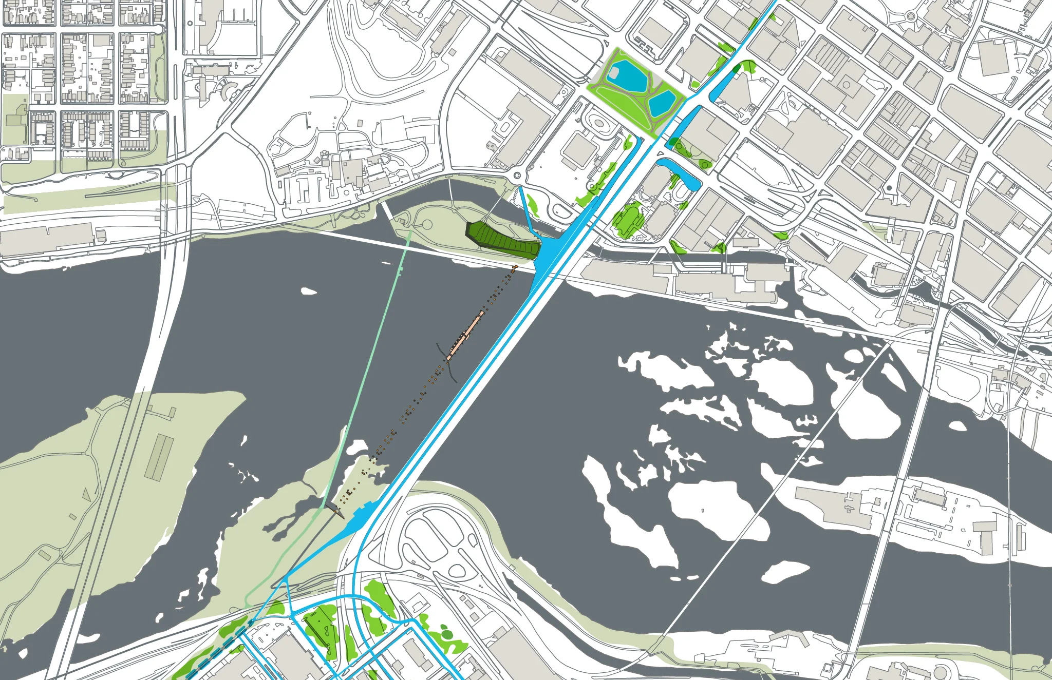
Detail of river-crossing section: Kanawha Plaza to Brown’s Island to BridgePark to Second Break Park; green spaces connected by human-scale pathways and plantings
The Path OF The PARKS
As a whole, BridgePark is a two-mile-long pedestrian and cycle urban connectivity greenway. The proposed City-level linear park system will connect the central business district, the seats of city and state government, and VCU’s world-class Medical Center campus in the north, to the fine grain streets of the historic and rapidly changing communities of the City’s South Side. Dramatic views of the historic falls of the James River, including the ruins of a railroad bridge - burned at the conclusion of the American Civil War - would be the centerpiece of the park experience.
The BridgePark path travels past five national historic landmarks and within a short walk of five more, including the John Marshall House, Virginia State Capitol, Wickham Valentine House, American Civil War Museum, and historic Jackson Ward neighborhood. The park’s path adjoins Richmond’s Slave Trail, adding stories of empowerment, self determination, and escape to the important lessons along that trail.
The project ties many east-west urban initiatives together - such as the city’s new PULSE high-speed rapid bus network - via a system of interconnected parks, event spaces and public art opportunities along an important north-south spine and seeks to prompt further complementary development and connectivity beyond the boundaries of the project.
At its widest-scale, BridgePark aims to reconnect communities that were separated from the City Center by a series of mid-century infrastructure projects.
On both sides of the bridge, along a contiguous pathway, BridgePark seeks to repurpose currently barren and oversized vehicular infrastructure for non-vehicular use, including active green spaces, tree-lined walking paths, and a bicycle ‘superhighway’ from an underused median on the Manchester Bridge.

Hull Street and Commerce Street Before

Hull Street and Commerce Street After: Seamless walking and bicycling routes with a beautiful riparian overlay leading visitors to the James River to the north and to the booming Hull Street corridor to the South

9th and Byrd Street Before

9th and Byrd Street After: An expanded Kanawha Plaza and accompanying walkway and bicycle super-highway welcome visitors to downtown to the North and the beautiful James River to the South

9th and Leigh Street Intersection Before

9th and Leigh Street Intersection After: A vibrant, green park space and path serving as a welcoming gateway to the East End, Navy Hill, VCU, Court End, Central Business District and Riverfront